I intended to go to Rampart Lakes today but WSDOT had other plans. About a mile east of the Snoqualmie Pass summit I noticed a trio of WSDOT trucks ahead on the shoulder of the road. Faster than a bunny, they pulled directly in front of me, blocked all three lanes of traffic. While my original plans were grinding to a halt in the name of road widening, a quick exit at Hyak opened other options. I crossed under I-90 and continued east on the paved frontage road approaching the construction area. The road narrowed, turned to gravel and curved both up and to the north. After passing the Lake Margret parking lot the road climbed to a pass at about 4,800 feet and while there were several spur roads, none obviously led to a trail. The road dropped more than 1,500 feet heading toward Lake Kachess. Along the way, I spotted a road to the left and came across three men foraging for chanterelle mushrooms. I chatted with one who explained they picked the tan and white ones and left the "plastic ones with a hole in the center" alone. Although it seemed like good advice, I'll stick with the markets for my fungi unless I have an experienced guide. After driving a couple of miles further I spotted a familiar intersection and turned left toward the Rachel Lake parking area.
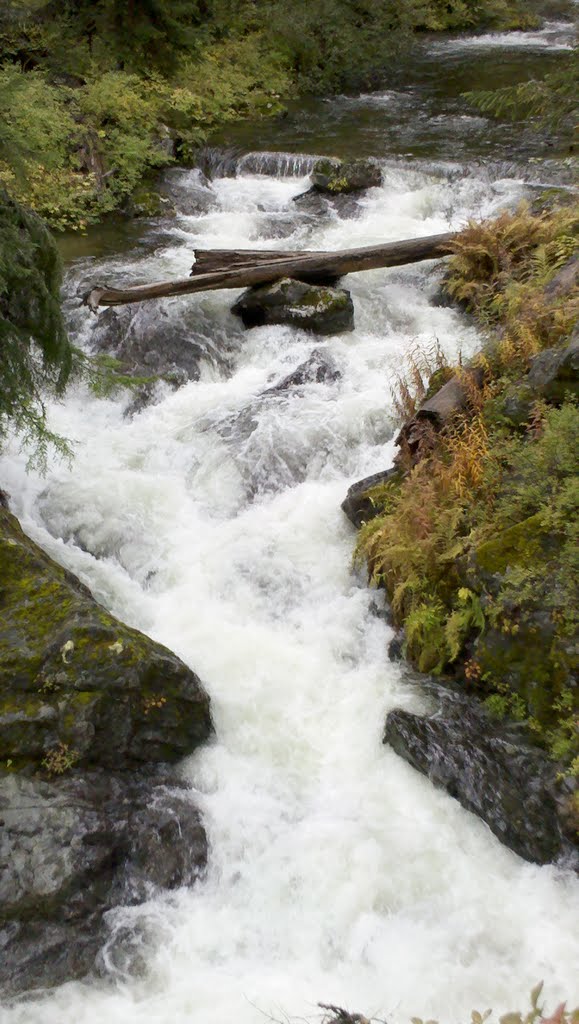
For the first time all year the parking lot at the trailhead was completely abandoned. It made sense considering how hard it was raining in Seattle but as luck would have it the skies were holding their water in abeyance, at least for the time being. The trail was another matter and it must have been raining in the area quite recently. There was a combination of small torrents flowing right down the trail and many muddy low spots that required nimble feet to have any hope of dry feet. There were some great views of Box Canyon Creek blasting over boulders and under logs on the way up.


The trail follows Box Canyon Creek along a gentle grade for about two and one half miles before it crosses a side creek and heads steeply up a headwall to reach the lake. Unfortunately, the creek was high and the stepping stones and rocks were awash with swift water. I studied the crossing for several minutes weighing my options. While I was reasonably confident I could make it across on the way up, I was concerned that the heavens might let loose a mighty downpour, which would make the return crossing more treacherous, especially in the late afternoon with failing light. That, and the lack of company on the hike made the choice easy, if somewhat disappointing, and back to the car I headed.
I drove the same route on the return trip and explored a couple of the side roads near the top of the pass. This proved nearly as risky as the creek ford. One stretch of road was rutted at least 1 1/2 feet on a steep grade and it proved necessary to straddle the rut to keep from high-centering the Highlander. I didn't relish the idea of hiking out if I got the vehicle stuck so I was glad to make it back to the main road safely.
For the traditional route to Rachel Lake, see:
Rachel Lake Trail Description

No comments:
Post a Comment