Sunday, March 18, 2012

Hiking in the Desert

I was visiting my father in Palm Desert last week and needed some exercise.  A Google search on "Palm Desert hikes" brought up a network of trails along Highway 74, which luckily was quite nearby.  After driving 1/2 toward the heart of town, access is behind a church, skirting through a neighborhood.  There is abundant parking along a split rail fence, but the trailhead proper is a little tricky to see right off the bat.  A wide band of sand with tumbleweeds and the like stand between the parking lot and the trail, which climbs sharply up the spine of a ridge.

The first part of the trail was a series of steps, which transitioned into a steep rocky path. Many other folks were enjoying their exercise during the cooler part of the morning.  Most were headed to a large cross that is illuminated at night.  After a half mile or so the grade became more gentle and it was fairly easy going to the cross.  After reaching that goal, I had lots of energy left and decided to continue on. At first the trail dropped a hundred feet or so and then it leveled off following along contour.  I came to a tee and luckily a fellow hiker, the first and only person I saw after passing the cross, explained my options.  I followed her advice and the trail soon dropped into and out of a narrow canyon.  Rushes  and a small pool of stagnant water gave evidence of water flowing just under the bed of the dry creek. 

Soon, I came across the entrance to a golf course.  Only in Palm Desert will you find a two-lane divided golf path. 
Although the hiking trail is clearly marked on the far side of the golf path, the trail apparently terminates in a gravel road for a construction site.  After stumbling around for few minutes, I guessed that the trail continued uphill and sure enough it came into view a short time later.  About a 1/5 mile later the golf course faded into the distance and several houses in various states of construction were visible on the slopes ahead.  To the right, the hillside rose sharply and the trail was visible snaking steeply up the flank.  I was nearing my self-imposed turn-around time and I headed down after about 3 1/2 miles one way.  The trip back was uneventful although I was running short of water and wishing I had brought some extra sun screen. I came across a flowering cactus near the cross as I made my way down.

The trail offers some great views of the valley too.

All in all, it was great to find a trail so close to where I was staying and I expect I will try it or one of the other nearby trails on my next visit to the desert. 

Saturday, December 3, 2011

Lake Annette- Swan song for 2011?

November 20th is late in the season for Lake Annette, which at about 3,500 feet is nearly at the same elevation As the top of Summit West, just on the other side of the ridge. There was about 8 inches of frozen snow in the parking lot, which made parking a free for all event.

Parking near the middle of the lot due to deep, frozen snow.

The trail was snow-covered but the snow was soft with good footing.  The temperature was in the upper 20s at the start and dropped gradually as the trail ascended.  The bridge crossing Humpback Creek gave a good indication of the snow depth.
Bridge over Humpback Creek


Humpback Creek
I only encountered one hiker on the way up who told me the lake was frozen, cold, and windy.  He was right.  Two hikers and their dog were heading down as I arrived. The snow was almost two feet deep in places and loose off of the beaten path, which made getting around a chore.  The piercing wind cut my stay short and I was heading down within 15 minutes.  Still it was an excellent day in the mountains and well worth braving he cold.

View from Lake Annette

Last bit of sun on the ridge west of Lake Annette

Saturday, November 19, 2011

Lake Melakwa on a Clear, Crisp, November Day

Early November is a transitional time in the Pacific Northwest; traces of later summer sun occasionally linger in the air although blustery winds and driving rain are the norm.  Weather on November 5, 2011 was of the former variety.  Temperature at the trailhead was in the upper 20's and it cooled off as the trail climbed to higher elevations.  The trail up Denny Creek has an odd beginning,  crossing under I-90 which is elevated about 80 feet above the ground surface in this area.


I-90 above the trail

Warning sign at the Denny Creek crossing
 There used to be a nice bridge crossing Denny Creek but it was washed out during a storm a few years ago.  Now there are a couple of boulders and some slippery branches to walk across.  It makes one hope that the weather doesn't change after crossing the bridge. 
The Tooth, with frosty trees in the foreground.
Last of the fall colors on a crystal clear day
The trail was clear of snow for 3/4 of a mile past the creek crossing until it finally crossed the snow line.  Gradually the snow depth increased to about 2 inches at Hemlock Pass at an elevation of 4,600 feet.  In addition to the snow, there were a number of blown down trees recording the effects of strong winds funneling between the peaks.

Blow-down at the pass


Beyond the pass the trail drops gradually below a ridge. In one spot, a cluster of crystals were poking out from the hillside.  Some of them were nearly two inches long and curled in many different directions creating intriguing patterns. 
Ice crystals next to the trail
Lake Melakwa
The lake was spectacular, framed by frosty trees, and peaks covered with a thin dusting of early season snow, topped by a brilliant azure sky. The lake itself was starting to form a thin film of ice marking the beginning of winter.  The near side of the lake, where the trail ends, was in the shade and quite chilly.  After a snack of buffalo jerky and an apple, it was time to head down to the car.

Monday, October 24, 2011

Silver Peak


Someone at work relayed information about their attempted hike toward Silver Peak a couple of months ago and it has been lurking in the back of my mind ever since.  Silver Peak stands above Lake Annette, a frequent destination of mine and I have often wondered how to reach it.  A quick review of the www.wta.org website provided instructions and several trip reports.  The trailhead is reached from FR 9070, which begins in the Hyak parking lot.  The Cold Creek trail follows the creek for a little under a mile to a tee at Twin Lakes.  
Cold Creek near the trailhead

One of the Twin Lakes
 Following instructions, I took a left and crossed the creek over a single log bridge and began angling up more steeply at the base of a north facing slope.  Slide debris including a patch of last season’s snow, covered the first section of trail, which foreshadowed another dozen or so downed trees blocking various parts of the trail over the next mile and a half.  The trail, where visible, switches back, often quite steeply, to another tee at the Pacific Crest Trail.  Mirror Lake is ½ mile to south but will remain a mystery for another day. 
Sign marking a tee in the PCT
Pacific Crest Trail
Instead, I turned right noting that Snoqualmie Pass is 7 ½ miles distant.  I chatted with an elderly couple who described the turnoff for Silver Peak- a rock cairn on the left side of the PCT marking a “climbers trail.”  The PCT between the tee and the Silver Peak trail sloped down at a gentle grade, crossing wet meadows through a mix of conifers and vine maples in their fall glory. 


The climbers trail begins in a huckleberry and salal meadow but soon enters a forest following a small steep creek upwards.  After ½ mile the landscape opens and the two-tiered flank of Silver Mountain comes into view.  The first tier consists of switchbacks crossing a pile of crushed rock rubble that leads to a short forested plateau.  The final approach is steeper and the rock is more competent.  
Climber trail zigging up the left flank of Silver Peak

Cross-country trails below the peak
Annette Lake looks so tiny from Silver Peak!
There is a 360 degree view from the top of Silver Peak with Annette Lake lying surprisingly far below to the west.  Both the east and west approaches of I-90 are visible along with a patchwork of interconnected roads that are used by cross-country skiers in the winter.  

Fellow hikers at the top of Silver Peak.
After enjoying a quick snack, I descending the climbers trail, passing two families with two kids, not more than 10-years old each.  The young ones seemed content but they hadn’t reached the steepest sections yet.  When I reached the PCT I turned north to make the hike a loop.  After reaching the FR 9070, I turned right and headed for my car.  After a couple of miles of trudging, a couple of hikers I had seen on the peak slowed and gave me a ride the last mile to my car.  Still it was probably a 10-mile day and my legs were grateful for the rest.

Monday, October 10, 2011

There's goats in them thar hills

The Teanaway Valley is quite a jaunt from Seattle- probably 2 hours to the turn off of 970 after leaving I-90 in Cle Elem.  At first the valley is wide, flanked on either side by farms and ranches. Soon the hills close in rising steeply from the edge of the road.  After 13 miles, the pavement ends and a gravel road that begins with tooth-jarring washboard leads the rest of the way up the canyon.  Luckily, after a couple of miles, the washboard gave way to a smooth, lightly wetted dirt surface that allowed the pace to nearly triple. Two forks in the road offer meager clues in the form of signs with numbered trail destinations, each different from the sought-after trail head.  Two lucky guesses led to the trailhead 9 miles past the end of the pavement.

At the trailhead, amongst the usual signage about parking permits and trail lengths, was an extraordinary warning about mountain goats.  It hit home because this earlier this summer, an experienced hiker had been gored and stomped to death by a belligerent male goat in the Olympic Mountains.
Further up the trail, at the top of a pass was another warning sign about goats.  The last line, partially cut off in the photo reads:  "Goats will destroy the plants."  Who knew that goats were a danger to flora and fauna alike?

The trail, goatless for the day as it turned out, rises steeply along the left bank of the North Fork of the Teanaway River.  The first 1/2 mile or so are as wide as a jeep trail and rocky.  Soon the trail forks, and Ingalls Way, which leads to Lake Ingalls veers to the right.
Ingalls Way Trail
The trail climbs through nicely spaced trees for another 1/2 mile until the vista opens dramatically with a steep, unvegetaged rocky slope rising rapidly to the right.Across the valley, Esmeralda Peaks East assumes a near-perfect pyramidal shape first looming above and eventually almost directly level with the top of the trail.
Esmeralda Peaks East


The ground is covered with an array of rocks with interesting colors.  Some freshly broken surfaces are dark green to black with a glassy appearance.  The rocks are dense ultramafic rocks of the Ingalls Complex, mapped in a 882 page thesis by a hearty PhD student in 1980.   The trail tops out at about 6500 feet and offers a choice left along the main trail or right on an alternate.  At the top of the ridge, the season first snow and falls glorious larches spring into view.
Larches and early fall snow.
The main trail drops a bit before following along contour, crossing small brooks surrounded by one of the few patches of grass-covered soil.  Finally, the trail follows an alignment of boulders crossing smooth rock faces with rock cairns to guide the hiker.  The trail bends sharply to the left and upward at an alarming angle at times requiring a four-limbed scramble.  Shortly, the hiker is rewarded by a view of Lake Ingalls, little more than 1/4 mile across surrounded by vegetation-free rocks on all sides.
Rare patch of grass
View down Esmeralda Valley
Ingalls Peak juts from behind the left side of the lake while the craggy ridges of Mt. Stuart rise to the right rear of the lake.  The trail is about 4.5 miles in length and gains 2,300 feet along the way.  In spite of a 5 hour round trip drive from Seattle, the spectacular views are well worth the effort.

Mt. Stuart


Lake Ingalls

Tuesday, October 4, 2011

Bears and Berries

Fall in the Pacific Northwest means many things: the days become shorter, the rain sets in, berries ripen, and bears are fattening up for the winter.  It's also time to strengthen up for ski season.  For me, that meant a trip to Granite Mountain.  As I switched shoes at the parking lot the rain began to fill the trunk of my car. Entering the forest it wasn't obvious whether the fog was thick or the clouds were low and think, in either case the visibility wasn't much more than 100 feet.  At least the canopy dampened the rain and it began to soften as the morning wore on.  The trail follows an old logging road for 0.7 miles and continues on to Pratt Lake.  The trail to Granite Mountain cuts off to the right where it gets narrow and steeper, rising through a second growth forest.  Soon, the trail hits an avalanche shoot falling from the exposed southern face of Granite.  The trail winds up and across the gully and enters another patch of trees before rising and crossing two more avalanche paths.  Finally, the trees clear at about 4,200 feet and the slope is covered with huckleberry bushes and other low-lying vegetation.  As I was getting tired, the huckleberries drew more and more of my attention: for their anti-oxidant properties I kept telling myself, my cardiologist would be proud!
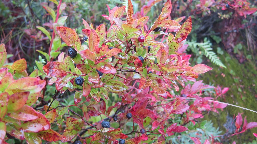
Huckleberries on the bush

I gathered then individually and by the handful depending on how much of a rest I needed.
A handful of delicious huckleberries.
 Trudging up a bit further I came across a pile of fresh scat, full of the same berries I had been enjoying. It wasn't steaming but it got my attention and I kept on the lookout for my berry-picking competition.  The trail climbs steeply in a series of braided paths reflecting the number of people who frequent this area and the erosive force of the runoff that drains the hillside. Further up, the trail enters a gully and the hard work of trail crews is in evidence in the shape of rocky paths placed to cover deep ruts in the easily eroded soil.  At the end of the gully, the trail flattens for a bit before the final climb of about 500 steep, steep feet.  Here, the last vestige of snow was lingering in what was presumably a shady spot on the north side of the mountain.  Of course proving this theory requires a bit of sun for proof.

The end of hike is a fire lookout accessible by a steep staircase. A friendly volunteer ranger welcomed me to come in a warm up.  He was up for a long weekend and a couple of his coworkers had joined him for the day.  All three work for King County Parks on trail rehabilitation and habitat restoration projects.  Soon we were joined by three woman who had spent the summer on Bainbridge Island at the Islandwood facility in an environmental education program through the University of Washington.  It was a small-world moment to have seven people working on related subjects meet at the top of a rain-soaked mountain.

Granite Mountain lookout on a sunny day, photo by laffertyryan (Flickr)


Sunday, October 2, 2011

Are you Sasha's Mom?

Last weekend I returned to Mason Lake to see the sites after the snow had melted. Last time, I was there with my sons Austin and Douglas when the approach to the lake was covered with snow.  This time the trail was snow-free and people-full.  It was hard to find a spot to park when I arrived and there were several groups gathering their gear as I headed up.  The weather was warm but pleasant and I made good time and got away from the crowds.  About 2 miles in the hike I heard a phone ring. It took a second to realize it wasn't mine so I started homing in on the sound; using a trekking pole, I pushed aside a few low-lying leaves and found the little noisemaker.  Returning a call from "Sasha's mom" eventually led to a post-hike meeting with Miriam and her grateful dad in Auburn.  They gave me a box of chocolates for my trouble, which was a big hit with the staff at work on Monday.  Until the arrangements were clear, I queried each group of females for Sasha, with no luck of course.

At Mason Lake there were a number of groups hogging the best spots.  Feeling chipper, I turned north on what I thought was the trail to Mount Defiance.  Soon, I reached Little Mason Lake, which is a pretty gem under the southeastern flank of Defiance.

Little Mason Lake with Mount Defiance in the distance.
Map of the Mason Lake area.
  Having a little energy left I pulled out my map and saw my error: the trail to Defiance to the east northeast.  I decided to bushwack my way which turned out to be challenging, especially the first part, which was a fairly steep slope covered with dense, face-high brush.

 The under-story thinned after  a couple of hundred yards and the going was fairly easy if unclear.  It was relief to hit the trail and I turned right back toward Mason Lake, leaving Defiance for another day.  The trail back to Mason was short and sweet with Lake Kulla Kulla below the ridge to the left and moss-covered trees everywhere.

Mossy trees on the trail from Defiance to Mason Lake.

On the drive back to Seattle I spotted an odd vehicle that was worth a picture.  Turns out it is a vintage, custom racing truck. It's a little hard to see, but the driver is wearing a leather World War I flying hat.
Racing Truck.