The Teanaway Valley is quite a jaunt from Seattle- probably 2 hours to the turn off of 970 after leaving I-90 in Cle Elem. At first the valley is wide, flanked on either side by farms and ranches. Soon the hills close in rising steeply from the edge of the road. After 13 miles, the pavement ends and a gravel road that begins with tooth-jarring washboard leads the rest of the way up the canyon. Luckily, after a couple of miles, the washboard gave way to a smooth, lightly wetted dirt surface that allowed the pace to nearly triple. Two forks in the road offer meager clues in the form of signs with numbered trail destinations, each different from the sought-after trail head. Two lucky guesses led to the trailhead 9 miles past the end of the pavement.
At the trailhead, amongst the usual signage about parking permits and trail lengths, was an extraordinary warning about mountain goats. It hit home because this earlier this summer, an experienced hiker had been gored and stomped to death by a belligerent male goat in the Olympic Mountains.
Further up the trail, at the top of a pass was another warning sign about goats. The last line, partially cut off in the photo reads: "Goats will destroy the plants." Who knew that goats were a danger to flora and fauna alike?
The trail, goatless for the day as it turned out, rises steeply along the left bank of the North Fork of the Teanaway River. The first 1/2 mile or so are as wide as a jeep trail and rocky. Soon the trail forks, and Ingalls Way, which leads to Lake Ingalls veers to the right.
 |
| Ingalls Way Trail |
The trail climbs through nicely spaced trees for another 1/2 mile until the vista opens dramatically with a steep, unvegetaged rocky slope rising rapidly to the right.Across the valley, Esmeralda Peaks East assumes a near-perfect pyramidal shape first looming above and eventually almost directly level with the top of the trail.
 |
| Esmeralda Peaks East |
The ground is covered with an array of rocks with interesting colors. Some freshly broken surfaces are dark green to black with a glassy appearance. The rocks are dense ultramafic rocks of the Ingalls Complex, mapped in a 882 page thesis by a hearty PhD student in 1980. The trail tops out at about 6500 feet and offers a choice left along the main trail or right on an alternate. At the top of the ridge, the season first snow and falls glorious larches spring into view.
 |
| Larches and early fall snow. |
The main trail drops a bit before following along contour, crossing small brooks surrounded by one of the few patches of grass-covered soil. Finally, the trail follows an alignment of boulders crossing smooth rock faces with rock cairns to guide the hiker. The trail bends sharply to the left and upward at an alarming angle at times requiring a four-limbed scramble. Shortly, the hiker is rewarded by a view of Lake Ingalls, little more than 1/4 mile across surrounded by vegetation-free rocks on all sides.
 |
| Rare patch of grass |
 |
| View down Esmeralda Valley |
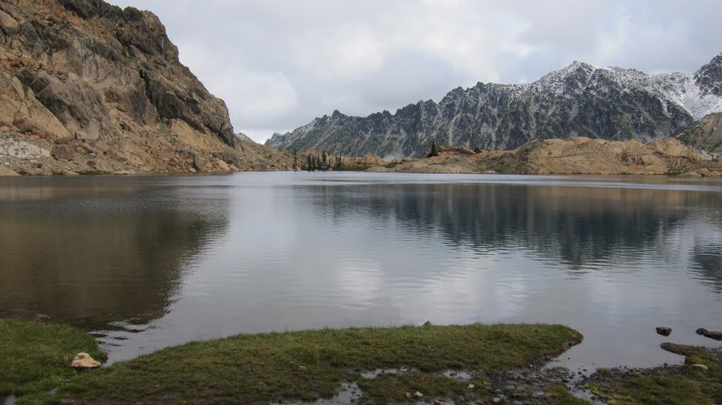
Ingalls Peak juts from behind the left side of the lake while the craggy ridges of Mt. Stuart rise to the right rear of the lake. The trail is about 4.5 miles in length and gains 2,300 feet along the way. In spite of a 5 hour round trip drive from Seattle, the spectacular views are well worth the effort.
 |
| Mt. Stuart |
 |
| Lake Ingalls |


No comments:
Post a Comment